Sunday, October 30, 2016

Perth to Boddington

October 23 to October 30
Monday we spent in Rockingham, another cold (190C) and windy day, and Monday night we stayed at CMCA Member Stop Over property at Stake Hill, between Rockingham and Mandurah.
Perth has some great sculptures throughout the city
Tuesday was back into Perth and to the caravan park fairly early to get a couple of loads of washing done. Leah had a 9am appointment on Wednesday with the Orthopaedic specialist. Unfortunately the break alignment had deteriorated over the week, mainly due to the cast loosening as the swelling lessened. The specialist was keener this time to advocate surgery, because if the bones fused at the alignment they were in, Leah would have reduced flexibility and potential discomfort long after healing. After discussions we agreed to re-align and recast the wrist one more time to see if the bone alignment could stabilise. The Doc was very pleased with his work after the realignment, so we have another appointment next Wednesday to check the progress. We are getting used to this routine, and the public transport.
The public transport in Perth is great. When in Perth we have been staying at a caravan park near the airport in Ascot, the bus stop is only 100 metres from the park. The buses are clean, modern, frequent, quite cheap and on time. Another observation, most of the commuters call out “thanks” or “cheers” to the bus driver as they disembark, including nearly all adolescent travelers! Does that happen in other cities? We don’t catch buses “over east” as a rule, so we have been very impressed by the system here and the patrons.
Wednesday night we treated ourselves to a trip to the Burswood Casino for dinner (another bus commute). It is a fully integrated Crown facility including a concert hall, with two additional new hotel towers to open in December.
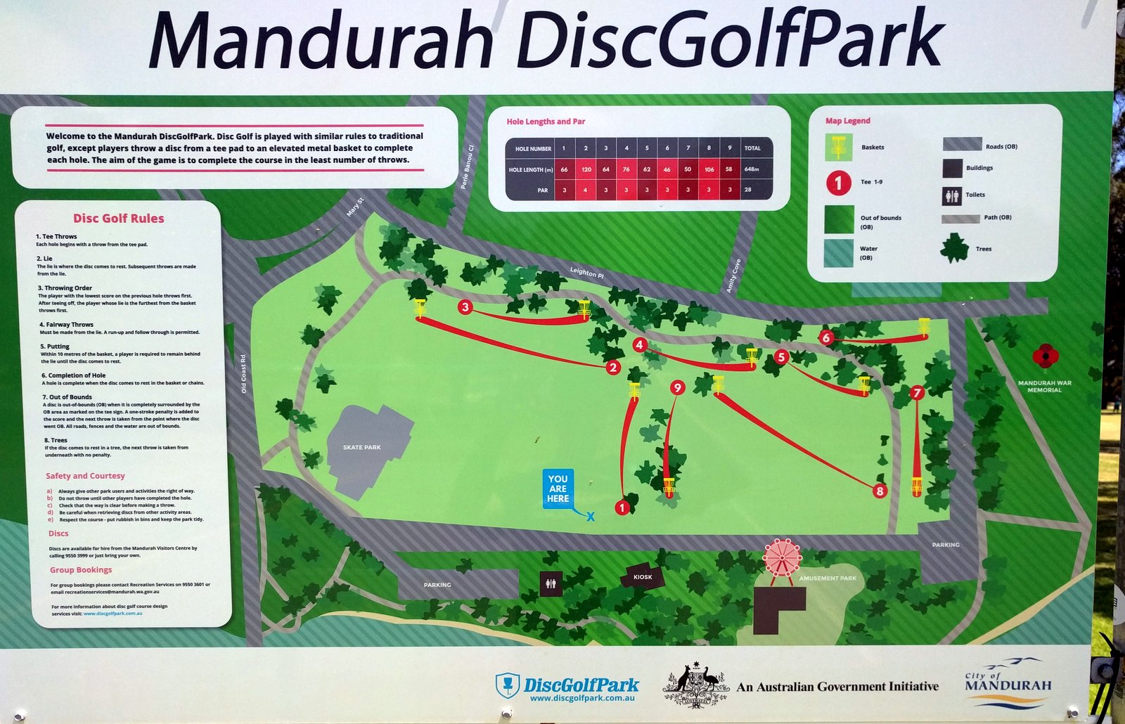
Course layout for "Frisbee Golf"
We departed Perth Thursday to visit Mandurah, around 90km south of Perth on the coast. Another great coastal town, easy to get around and an interesting setting with a large inlet of water dominating the southern side. There is also numerous housing and development canals around the city area, and dolphins frequent the canals. Some areas have a gone for a “Venetian” look and feel with their canals, and it’s worked.
In the afternoon we drove 15km east to Pinjarra, an RV friendly town with a free camp at the (now historic) old train station. Freight trains still service the southern WA industries on these lines so they were regularly trundling past.
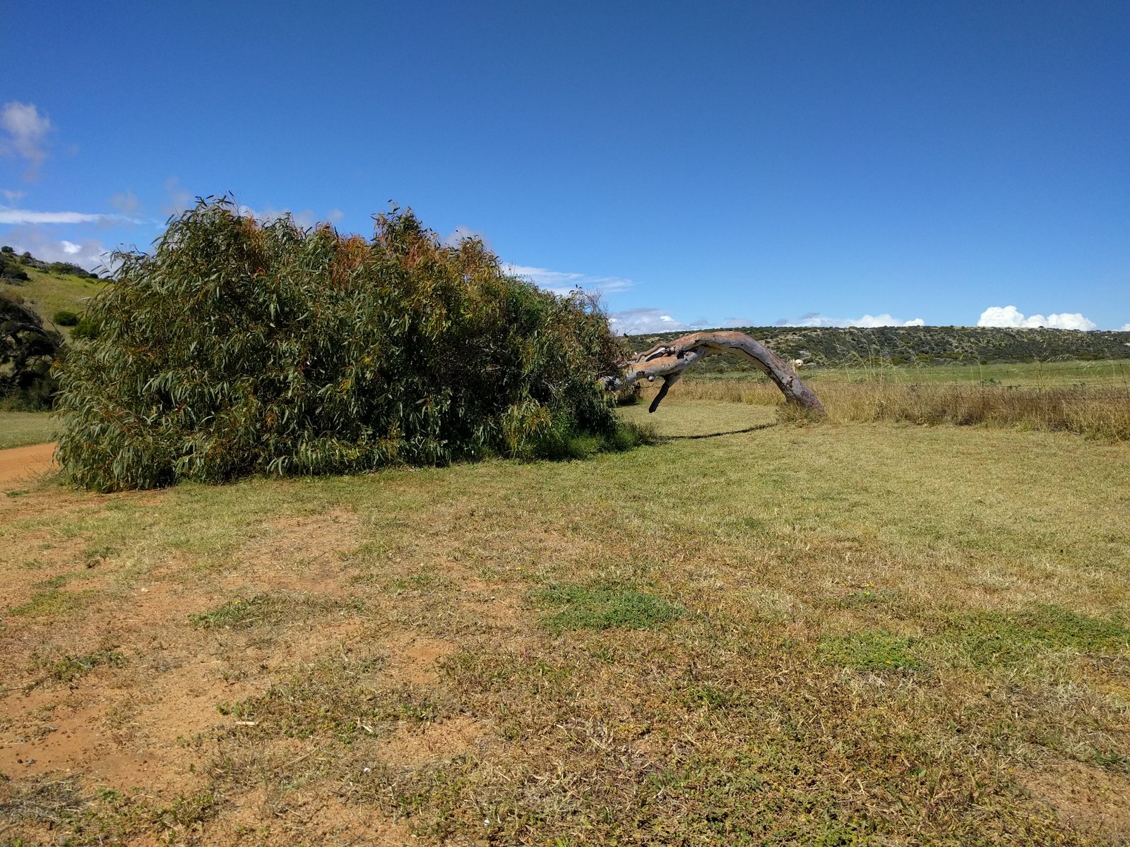
Another sculpture, Boddington style
Friday morning I had a local mechanic replace the thermostat in the motorhome as the existing one had been sticking and not fully opening or shutting. We then drove back to Mandurah to further explore the town, stopping on the way for the ritual morning coffee for Leah (when I start the generator so we can make a decent “coffee pod” cappuccino). Pod machine won’t turn on! Two days ago the electric jug (which we only use at caravan parks when I make tea) died! Let’s hope things only happen in two’s. Mandurah did well out of us replacing these two items.
We found a Frisbee Golf park in Mandurah, and I hadn’t packed a Frisbee! We watched a few groups playing, then I promptly went out and bought one. You can hire them, but you can play anytime for no charge if you have your own.
Boddington Free Camp, right on the Hotham River
We drove 80km east to Boddington for Friday night. Boddington is an active mining area with bauxite and gold mined around the town. They have a free camp in town along the Hotham River.

Saturday we explored Boddington, even though it was (again) cold and windy. They have numerous bush walks in the area which we did to keep warm. We stayed Saturday night as well, and after a lazy Sunday morning headed to Jarrahdale, where we had stayed a few nights last week. It is a great little town, and only an hour from “our” caravan park in Perth.

Sunday, October 23, 2016

Perth to Jarrahdale

October 16 to October 23
  
Wildflowers at our free camp, Jarrahdale
Sunday night was spent in Beverley in the Avon Valley, another small, RV Friendly town about 80km east of Perth. We had a lot of paperwork/admin (tax, etc.) to do, so Monday we headed to York for the day to catch up so we could visit some offices in Perth on Tuesday.  
We found the Midlands City centre (an outer suburb about 20km from Perth) a better option for access and parking than Perth, and had all the services we needed. After that we checked in to the Perth caravan park in time to get some washing done (it can’t be all holidaying when you live on the road).
Single Men's Quarters, Old Jarrahdale Timber Mill
Leah had a Wednesday morning appointment with the Orthopaedic specialist to assess the progress on the wrist break. The bone alignment wasn’t maintained over the week. They still think operating and plating the break is an option but not preferred yet, so they reset and re-cast the wrist and want us to return next Wednesday to see if the alignment is holding.
View south into Shoalwater Bay
from Cape Peron, Rockingham
This means another week to do some “not too distant” touring before returning to Perth City. Thursday we decided to travel south east and our first stop was Fremantle. We had a walk around the town centre and waterfront before driving to Jarrahdale, about 60km from Perth City. It is another RV Friendly Town in the southern foothills (a bit like Montville on the Sunny Coast but smaller), offering a great open area to free camp around 1km from the town centre (well, the pub). Jarrahdale has a long history as a timber town, commencing in 1870 and only ceasing in 1997. The free camp is next to the old saw mill and the single men’s quarters. A lot of time, money and effort has been channelled into opening up the heritage areas for tourists, and restoring building where they can.
Sculptures on Rockingham Beach
It is also where Alcoa opened their first West Australian bauxite mine in 1970 (no longer operating, that site is now a fantastic mountain bike park, Langford Park).
Jarrahdale abuts the Serpentine National Park, with some great bushwalks accessed from our camp area.
Thursday, Friday and Sunday were spent locally in Jarrahdale exploring the above areas and attractions. Friday night was wood fired pizza night at the pub, bonus!

Rock formation off Cape Peron, Rockingham
Saturday we drove over to the coast, to Rockingham. What a great place! A really pretty coastline of protected bays and the fantastic Cape Peron with its walking tracks and rocky coastline. Rockingham also had a sculpture competition and entries were on display on the foreshore and beach for a fortnight. We hiked all over Cape Peron and enjoyed the warmest day for ages, around 250C. 

Sunday, October 16, 2016

Perth to Wave Rock to Perth

October 9 to October 16

Geordie Bay, Rottnest Island
Monday morning we had an early start to meet with the ferry from Perth City, out through the Swan River past all the mega-rich mansions, and on to Rottnest Island. Once on the Island we did the guided bus tour, which not only gets you around the whole island (about 22km) easily, but the commentary gives a better overview of the sites and history of Rottnest.
Aside from being a fantastic and picturesque holiday island today, it was the first salt mine in WA (in the early 1830’s), a “boys reformatory”, and for nearly one hundred years was an aboriginal prison. Although we had cool temperature, the wind was unusually gentle and the sun was out, so it was a great day to visit.
A Rottnest local, the Quokka, not Leah
Tuesday we planned to leave our caravan park near Perth City and visit the Avon Valley, about 100km east of Perth. About 9am Leah was just returning to the motorhome when she slipped on the shade cloth that the caravan park has laid on the ground (where the annex goes). Putting her left hand out to break her fall, she broke her wrist. A quick trip in an ambulance (photo for you, CJ), and a few hours at Midlands Hospital, we had Leah in a cast and needing to see an Orthopaedic Specialist to assess the damage. The break can’t be assessed until the swelling recedes, so we have an appointment to see a specialist in Royal Perth Hospital next week. We will fill you in on the details in our next blog post. Hats off to the Western Australian public hospital system, Leah had fast and attentive treatment from both the paramedics and the hospital.
Leah being well looked after
Fortunately we had no firm plans for the near term, so we decided to still visit the Avon Valley area, and extend the eastern trip so we could return to Perth next Wednesday. Monday night we stayed in Wundowie, around 60km from Perth, at a Member Stop Over (CMCA member’s property where they welcome fellow motorhomes to park on their property). We were met by Ron and Kerry, who were very sympathetic to Leah’s predicament, and had cooked fresh scones for us. This was way above and beyond the host requirements but much appreciated under the circumstances.
Wednesday we travelled to Northam, the start point of the Avon Decent, a well-known river race each August (subject to river flow) where everything from kayaks to speed boats tackle the rapids of the Avon River for 130km towards Perth. After encountering very few RV Friendly Towns in WA, the Avon Valley (and further east in the Wheat Belt) have gone out of their way to be RV friendly and attract the touring market.
No words can describe the spectacle of Wave Rock
We drove to York to stay at their free overnight parking area, right on the Avon River in town. They even offer free power for four lucky campers, and we scored the forth! We reciprocated by doing a shop in their IGA and filling up our fuel before departing on Thursday.
One of our tourist brochures recommended a tourist loop drive to visit Wave Rock, a well photographed granite formation deep in the Wheat Belt. We had planned to visit from the south as we left WA, but decided to do the 600km loop drive as we had time to burn waiting for the doctor’s appointment. The loop drive takes you via many of the sights in the region and through numerous small, friendly farming towns.
Hippo's Yawn rock formation
Thursday was the first hot day for this region, 350C, but low humidity, so it was a nice change from the cold. We visited a couple of very large monolith granite rocks in the region, which range from the third largest in Australia (behind the obvious largest, Uluru). Many of the rocks aren’t fully exposed like Uluru, with much of the rock hidden underground. Narembeen has a well presented Grain Discovery Centre, mapping the history of grain farming (wheat, oats, barley, etc.) in the wheat belt. We stopped overnight in Narembeen, the shire offering unpowered sites at their caravan park at no cost.
Wave Rock from the top, note the water diversion system
Friday was a short 85km drive to Hyden (pronounced eye-den) and to Hyden Rock, home of the amazing Wave Rock formation. It doesn’t matter how many photos you have seen, this rock will still have you in awe. We were recommended to visit outside of weekends, and we had no trouble getting photos without anyone else there. The whole Hyden Rock, including Hippo’s Yawn and other cool rock features, was a great morning’s visit, with plenty of walking tracks around and over the rocks. Hyden Rock has a reservoir “hollow” which was once the fresh water collection and storage for the surrounding area. You can see the water diversion system on top of Wave Rock in some photos. The Wave Rock formation wasn’t even known outside of the locals until a photographer won an international photo competition in the 1960’s.
Tin Horse Highway leading to Kulin
We visited another rock feature about 20km away, The Humps, and Mulka’s Cave, housing hundreds of Aboriginal rock paintings, mainly hand prints. From there we drove via the Tin Horse Highway to Kulin. This started as another local tourism idea, originally to advertise the Kulin annual horse race, farmers have erected fun and inventive sculptures featuring horse likenesses in interesting poses. The sculptures now cover some 20km leading into the town.
Kulin have a terrific free overnight parking area just off the main street, and the pub has a pizza night every Friday night, we couldn’t have planned it better!
Gorge Rock with swimming pool, look closely,
Leah is down there somewhere
Saturday weather was close to awful, 170C max, 40-50km/h winds and showers. We still managed to visited the Motor Museum in town, receiving a guided tour from the elderly local who set it up, and walked the Macro Carpa wildflower reserve (yep, more wildflowers). We decided to stay Saturday night in Kulin as the locals were friendly, the camping area is quiet and the weather certainly wasn’t ideal for driving.
Sunday’s weather was far better (but still only 170C max) so we head back through the wheat belt towards the Avon Valley. We visited our last large rock, Gorge Rock, which was the local swimming pool and recreational area (public hall, footy field) for the Corrigin and Kulin region from the 1920’s.

We arrived back in the Avon Valley and stopped at another RV Friendly Town, Beverley.

Sunday, October 9, 2016

Cliff Head to Perth

October 2 to October 9

Cliff Head South free camp
Cliff Head is one of the first beach spots at the northern end of the Indian Ocean Drive, the coastal road that leaves Highway One (Brand Highway over here) about 300km north of Perth and tracks the coastline to Perth. This area was settled by lobster fishermen and a lot of the beach shacks are still in use. The sand tracks along the sand dunes run for kilometres at a time and link a number of shacks before feeding to the road. Then further down the road it all happens again, for about 50km.
We stayed at Cliff Head Sunday night then drove to a couple of other free camps to the south on Monday. Again the weather was kind with light winds so we trekked a number of the sand tracks and beaches. Unfortunately the beaches aren’t conducive to fishing as the seaweed from the reef a few kilometres off the beach is continually present and being washed up.
Interesting Wildflowers
We stayed at Cliff Head South on Monday night, a bit more crowded but more protected from the southerly wind that came up in the afternoon. It is still school holidays over here, and we wanted to stay in Jurien Bay for a couple of nights on our way down. With only one caravan park in town, we were lucky to secure a site as I only called a couple of days ahead. Jurien Bay is the main centre of the Turquoise Coast, the 200km coastline from Port Denison to Lancelin.
I should mention again that it is wildflower season here, and this last 400km to Perth is renowned for the diversity and abundance. This has been an exceptional season (apparently, according to the thousands of tourists who flock here), and although this wasn’t one of the planned highlights, we have been really enjoying the amount, colour, shape and variety we have encountered.
More Flowers
We arrived in Jurien Bay on Tuesday. Only about 200km north of Perth, it was surprising to learn that the area wasn’t properly settled until the 1960’s. It is a spectacular bay protected by a chain of small islands and reefs. The water colour definitely lives up to the Turquoise Coast name. You can see why it is now a popular town for holiday makers, retirees and weekend beach houses. They are spending a lot of money rejuvenating the foreshore, and recently installed an artificial reef off the old jetty, a “snorkelling trail” to enhance the experience of the turquoise water. We enjoyed our two days in Jurien Bay, but were glad to leave the caravan park. I swear there were twice as many kids as there were adults staying at the park.
Thursday we drove to Cervantes and visited Lake Thetis. Lake Thetis is a dune locked lake with high salinity and stromatolites growing in the shallows. The sand dunes in this area are migratory, moving with the winds and ocean forces, and can move hundreds of metres in only decades.
The Pinnacles
Fifteen minutes down the road is Nambung National Park and the Pinnacles. The Pinnacles is an amazing landscape where the desert meets the sand dunes. The limestone pillars formed (much scientific conjecture as to how) underground some 30,000 years ago, and have been uncovered as wind and erosion weathered the soft stone and sand from around the pillars. To walk around the park you could be in the centre of Australia, then to see the ocean and sand dunes from a lookout seemed out of place.
You can see the sand dunes and ocean in the background
Just 20km down the road from the Pinnacles we stopped at a parking area for the night. We were pacing ourselves to arrive in Perth on Saturday, to meet up with my brother Mal and his partner Emma, who are over for a few days for Mal’s work.
Friday was a short drive to Lancelin, another picturesque oceanfront town on a bay protected by islands and reefs. I am still surprised how quiet these towns are, only 100 odd kilometres from the capital. We had a great walk on the beach, and checked out the professional fisherman’s catch of shark (destined for the fish and chips shops of Australia).
With Mal and Emma at Kings Park, Perth
We stopped just outside Perth Friday night as the weather closed in. Rain and wind and cold made Saturday a lousy day for sightseeing, so we checked in to a caravan park near the city and met up with Mal and Emma in the afternoon for drinks and dinner.
Sunday was still cold and windy, but less rain, so we met up with Mal and Emma again and checked out the interesting sights around the Perth city area. Kings Park, the Perth Mint and the riverfront region were all worth the visit.

Saturday, October 1, 2016

Kalbarri to Cliff Head

September 25 to October 2
  
Kalbarri Cliff Coastline
We packed up Sunday morning and departed Kalbarri. There are numerous headlands and points of interest to explore as we drove south. We stopped at Island Rock and did the headland walk to Natural Bridge, fantastic cliffs. Hutt Lagoon further south at Port Gregory is known as Pink Lake for a good reason, its pink! A bacteria occurs naturally which forms beta carotene and is harvested for processing.
Hutt Lagoon - Pink Lake
We visited Lynton Station, where the Port Gregory Convict Hiring Station once stood in the 1850’s. The ruins have been uncovered and some have been restored after much lobbying and fundraising from the Station owners. It is now a self-guided walk with interpretive signs explaining the history. Convicts nearing release were housed here and hired out to assist farmers and miners.
We drove through Northampton and stopped overnight at another great roadside parking area on a ridge overlooking a farm.
Port Gregory Convict Hiring Station ruins
Our plan Monday morning was to leave Australia for a short while. We visited The Principality of Hutt River, 75 square kilometre property which successfully seceded from Australia in the 1970 and is now an Independent Sovereign State. It is a fully functioning independent state, has its own government, currency, stamps, flag, even their own passports which the residents travel under worldwide.
The land owner Leonard Casley had a beef with the Australian Government and very cleverly orchestrated the secession to prove a point. We had the pleasure to spend about half an hour with Prince Leonard, now 91, as he showed us some of his prised mementos, photos and letters. His extended family now operate the Principality and it is fully self-funded through tourism and agriculture. A very interesting and enjoyable morning.
An audience with Prince Leonard
We drove into Geraldton in the afternoon with a number of chores to complete. It was a public holiday (Queens Birthday) Monday, and ALL the shops were shut! Woolies, Coles, everything, all day! Fortunately Geraldton are about to become an RV Friendly Town, and have just designated a 24 hour overnight parking area right on the waterfront next to the port operation (we fortunately stumbled on it). I am guessing it will be officially announced next month, as it isn’t showing up on my camp site locator Apps. The WA Government have spent a massive amount of money on rejuvenating the whole waterfront area, finishing in 2014, and have done a wonderful job.
We stayed overnight and completed our chores throughout Tuesday as we also played tourist. We planned to visit Greenough (pronounced Gren-uf, the things you learn) but were running a bit late so drove a little further inland to stop overnight. On the hills behind Greenough is a large wind farm (windy …. Here …. Really?,. see photo of tree for proof) and a very nice rest area right next to one of the wind generators. The wind blew all night and there was a constant background “whoosh” of the blades, but we had the best night’s sleep! No ill effects from a wind farm for us.
Greenough Historical Village
Wednesday we visited Central Greenough Historic Settlement, a village of 11 buildings owned and managed by the National Trust since 1975 and maintained to prevent further deterioration. The area was settled in the 1860’s and thrived on agriculture.
In the afternoon we drove to Seven Mile Beach, about 11km (7 miles, nice) before Dongara. This is designated free camp spot for self-contained RV’s, and as you can see from the photo, pretty darn nice. Unfortunately the wind just keeps blowing 30km/h from the south, and with the air temperature maximum at 190, not ideal for beach activities.
Real tree, real serious winds around here. 
Thursday we drove into the twin towns of Dongara and Port Denison. They are two small coastal towns, separated by a river, and would be quite easy to drive through and keep travelling down the road. But unlike most WA towns, they are a registered RV Friendly Town. Not only do they offer free camping at Seven Mile Beach, and three other beach parks south of the towns, they offer one night only (in a 28 day period) free parking at their oval in town. They have a ranger tracking RV’s to keep everyone honest, which is great. This encourages travellers to stop and spend some money (they have a very good IGA), which we did.
They have a number of walks around the coastal dunes and the river which we did, and they have free WiFi in Dongara main street and along the foreshore in Port Denison. We decided to drive back to Seven Mile Beach for Thursday night, and use our one night in Dongara on Friday night.
Seven Mile Beach free camp.
We did plenty of beach walking (in two jumpers and beanies on one walk) at Seven Mile, drove into Dongara for more WiFi downloading and shopping, and parked at the oval. We had planned to have a meal in town since we were about 200 metres away, but the weather closed in and we got a lot of wind and rain so we stayed in.
Saturday we walked to the markets in Dongara before heading to the foreshore for more WiFi and “office work” before driving 30km south to another beach free camp, Cliff Point.
There are numerous four wheel drive tracks parallel to the beach that travel for kilometres accessing small camp spots. We walked a number of these as the beach was thick with washed up sea grass. The weather still isn’t too kind, 35km/h winds, 19o tops, rain squalls in the evening.
On Sunday we decided to stay another night as the weather is a bit kinder and we are still in no rush to go further south.