Saturday, January 28, 2017

Renmark to Blairgowrie

January 22 to January 29
  
The Murray, Lyrup
Sunday we were deciding where to head to escape the afternoon heat and the predicted 390C for Monday. There is a low cost camp at Lyrup, about 15km out of Renmark, right on the Murray, next to the vehicular ferry. Lyrup is one of the original 12 small agricultural towns which sprang up in 1894, when the SA Government created a communal land system. Lyrup was the site of the first grape plantations for Angove wineries, back in 1914.
South Australian Border, familiar trucking company
This low cost ($5 per night) camp has four power outlets for caravans or motorhomes available, on a first come first served basis, with a maximum three days stay. For the lucky ones, the power outlet is complimentary. We arrived at lunchtime, and were VERY fortunate to secure a powered site. It certainly makes those hot afternoons (2pm to 9pm) a lot more bearable in the air conditioning (I think we’re getting soft).
The mornings were still quite pleasant so we explored the town and walked and cycled the tracks along the Murray, leading to numerous permanent-looking houseboats moored amongst the reeds and willows.
30 Metre high wheat silo mural, Brim
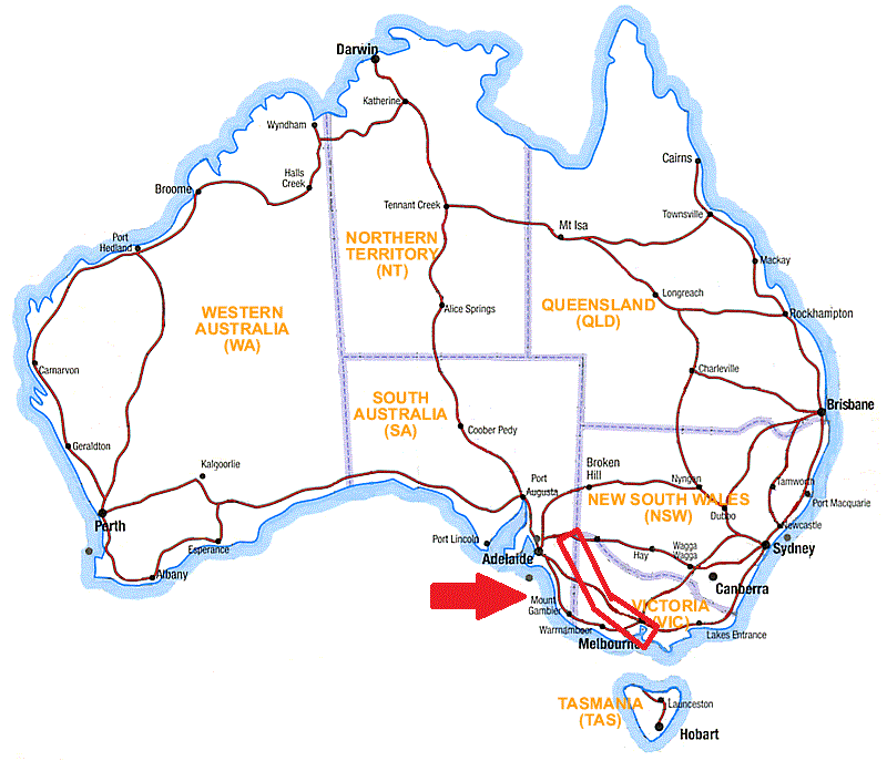
Tuesday we left Lyrup and drove east, having a coffee at the Victorian border as we headed to Mildura. A familiar branded “B” Double parked next to us at the border, check the photo. Once in Mildura we stocked up on essentials and drove to Kings Billabong, a free camping area on the Murray about 10km out of town.
We camped near Psyche Pumps, an important site in the history of the irrigation of the region. In 1877 the Chaffey Brothers purchased the entire “failed” Mildura Irrigation Colony from the state government, and developed a series of pumps and lagoons to lift water from the Murray and irrigate some 33,000 acres. 
Giant Koala, Dadswells Bridge
The Psyche Pumps were the first of the series built, and are still steam operational, being run regularly by the historical group. The region still produces 98% of Australia’s dried vine fruits, 75% of table grapes and 69% of almonds.
Wednesday we drove south through wheat and sheep country for a couple of hundred kilometres, passing through numerous small country towns. We stopped for lunch at Brim, at the lake just out of town. After lunch and a walk around the lake, we decided to stop for the night as it is a low cost camp area, and very peaceful.
As we left on Thursday we stopped at the wheat silos in Brim to admire the mural paintings. Painted last year, they are the first in a series of five rural wheat silo sites which are to be painted and become a tourist drive. As you can see from the photo the 30 metre high artwork is spectacular and the series will become a terrific tourist drawcard.
Hallowed turf, Stawell Athletic Club
We travelled south to Horsham before spending the rest of the day in the Grampians. This rugged mountain range are very popular with rock climbers and bush walkers. We walked the Beehive Falls trail, although the falls were unfortunately dry. We visited the “Giant Koala” at Dadwells Bridge before stopping down the road at Canadian Gully, a pretty lake with abundant birdlife.
Look at those guns!
Friday we visited Stawell, famous for the Stawell Gift professional foot races run every Easter. Central Park and the Stawell Athletic Club Museum were fantastic, with artefacts dating back to the first race in 1877.
From there we drove to Ararat, and visited the Aradale Asylum and J-Ward. Ararat was the home to institutionalised mental patients in Victoria since the mid 1800’s. Aradale was a purpose built township of some 70 buildings to house and treat “the growing number of lunatics in the colony of Victoria” (their words, not mine), while J-Ward was a high security modified jail for the “criminally insane”. Both these institutions were still operating until the late 1990’s. Unfortunately we couldn’t tour Aradale, but did a guided tour of J-Ward. It was both interesting and depressing to hear how they treated mental illness in the not too distant past. Friday night we stopped at a rest stop at Shelford, about 70km from Geelong.

Inside J-Ward, Ararat
Saturday we drove to Geelong and Queenscliff and on to the vehicular ferry to cross to the Mornington Peninsula. We have come this direction to stop in Blairgowrie at Margaret’s for a few days R&R (and chores, mail collection, etc.) before continuing around the coastline.

Saturday, January 21, 2017

Whyalla to Renmark

January 15 to January 22

Iron Knob Campground
Sunday we left Whyalla, not before receiving a bagful of homemade morning tea treats as a departing gift from the caretaker of the RV Friendly Park. We can’t speak highly enough of the hospitality we have received from the businesses and residents on the Eyre Peninsula. We also visited the Mount Laura Homestead Museum before leaving. This an original farming homestead that has been “engulfed” by the expanding town, and is now an historical collection of restored buildings and items. Although interesting, the whole place needs curating, it is currently just a massive collection without much organisation or effort put into the display.
We drove to Iron Knob, “the birthplace of Australia’s steel industry”. Iron ore was first mined by BHP here in 1896, to be used as flux in the production of lead at Port Pirie, from Broken Hill mine ore. They soon realised that the quality and quantity of the iron ore was so high, it changed the BHP director’s focus towards steel manufacturing, and justified the construction of the steelworks in Newcastle.
Original Iron Knob mine
The township of Iron Knob is only just hanging on as a town, the pub closed and there is no “council”, a volunteer group levy a small fee to the residents to help manage the town. They also run the visitor centre and tours of the mine area, as well as a well-resourced historical display. We stayed at the free RV Park in the centre of town on Sunday night, a well frequented stopover point for people travelling towards (or from) Western Australia.
Monday was due to reach 380C, so we arranged for an early tour (we were the only customers) as they don’t run it if the temperature exceeds 360C. Our personal two hour tour was really enjoyable, including a town tour and the history of the mines and BHP’s historical successes and missteps.
Port Augusta from the Water Tower Lookout
Following the tour we drove to Port Augusta, and after a visit to the Information Centre and the water tower lookout, we decided to check in to the Shoreline Caravan Park (right on the Spencer Gulf) for two nights. We had the usual washing to do, but Monday was to reach 390C, and Tuesday 420C, so we opted to hide away in our air-conditioning for the worst of this hot spell. Port Augusta is having a tough trot as a town, the power station recently closed, and the residue ash storage had been causing dust cloud problems.
Spencer Gulf, not a breath of breeze
Tuesday started out not too hot, and with no wind (WHAT??!!) I quickly rigged the kayak and went for a quick paddle and fish before it got too hot. A lot of fish travel up to the tip of the Spencer Gulf to spawn, and at the right time of year (not now, of course, late winter and spring) king fish, mulloway and snapper are resident. I had plenty of bites from small fish, and I had a great couple of hours in glass-like water, with a dolphin slowly tracking me for a while as I paddled up to Red Banks, “where the desert meets the sea”. By 11am and 350C I decided to yield and enjoyed watching tennis and cricket in comfort. Even though it is a drier heat, 420C is still crazy hot.
Red Banks, northern tip of the Spencer Gulf
Wednesday morning was cooler after a windy change during the night, and we headed out of Port Augusta after a visit to the town centre and doing some shopping. As Port Augusta is at the northern tip of the Spencer Gulf, we drove south following the coastline to Port Pirie. Port Pirie is a very industrial town with a large smelter and grain handling facility. A trip to the Visitor Centre and a walk around the waterfront before lunch (and the resumption of the heat wave), then we headed to Crystal Brook to an overnight free camp in town. We enjoyed the evening’s free entertainment from the Rural Fire Service volunteers training across the road from us.
Morgan Museum
Thursday we headed towards the Murray River. We have explored most of South Australia to the south of us at the start of our trip, so we’ll head along the Murray before visiting some central/western Victorian areas we haven’t seen yet. We drove through some very picturesque farming countryside once we left Crystal Brook and crossed the southern Flinders Range, through Spalding and Burra and on to Morgan, on the Murray River. Morgan was a busy rail and port hub (second only to Port Adelaide) from 1878 when the railroad was completed. We walked the heritage walk around the town and river precinct, where many historic buildings and structures are still standing.
The temperature reached 370C by 3pm and with the temperature not dropping until 9pm, we chose to drive to Cadell where a low cost campground (at the football field) has power available. A long line of thunderstorms passed through around 9pm, plenty of lightning and thunder but not too severe. Other areas around South Australia received 120km/h winds.
Murray River camp, Waikerie
Friday we crossed the Murray on one of the many free vehicular ferries and did a scenic drive along the northern side of the river. We crossed back at Waikerie and spent the day exploring the heritage sites in town and riverside cliff walk. Friday night we stopped at the free camping area on the Murray just outside Waikerie, where we watched the sculling rowers training in the evening and morning.
Saturday we drove to Barmera, about 50km along the Murray. Barmera is popular due to the very large Lake Bonney, where water skiing is big. It is also where Donald Campbell set the Australian water speed record in 1964. We enjoyed a lazy Saturday, walking along the lakefront and watching the watercraft. In the afternoon we did the scenic drive around the lake and visited Berri before driving to Renmark and another free camp on the Murray at Plush’s Bend. This is a low lying area that was made boggy by the Thursday night’s storms, but had dried out enough (just) to access.
Lake Bonney, Barmera - Donald Campbell Statue
Sunday the weather was due to get hot again, with 360C today and 390C Monday. We visited the riverfront and walked the river walk, before deciding our next move. We had thought we would leave The Riverland area and drive to Mildura, but their forecast was even hotter. I had one other idea for somewhere to visit and manage the heat, I’ll let you know how we went next week………

Saturday, January 14, 2017

Tumby Bay to Whyalla

January 8 to January 15

We departed Tumby Bay Sunday morning after a final walk along the waterfront and jetty. Driving north east we stopped at Port Neill, another village with fishing shacks lining a bay. The “walking trail” along the bay took you through the front yards of the shacks, mingling with the holidaymakers.
Arno Bay Hotel RV Park - Guarding the solar panels
After lunch we continued to Arno Bay. Although a (another) small fishing village, the local Progress Association is working hard to attract travellers and to improve and showcase the town. The RV friendly parking is in the back carpark of the pub, and costs $20 for three nights, and you receive a $10 voucher to spend in town. How could we resist that offer?
Monday we walked the Town Trail, a walk around the town with points of history to explore. The town is half a kilometre inland from the bay (and pub), and was settled in the late 1800’s as a hub for the local grain growers to ship their goods. We also walked the tidal creek and mangrove boardwalk.
Beach shacks at Arno Bay
The local charter fisherman uses the pub’s fish cleaning table after each charter, so I began to understand a lot more of the local fishing attractions. He was (unfortunately, or fortunately?) booked up for the week so I couldn’t have gone out, however he goes 40 kilometres offshore to a reef chasing snapper. Given it was blowing 25-35km/h winds each day, I think you have to be hardy to be out that far in the exposed ocean! Although they did catch some huge snapper (he was booked by the same four fishermen from Sydney, for four days straight), they didn’t catch too many. By the third day they gave me a couple of snapper “wings” (the part behind the pectoral fin to the gills) as they only wanted the fillets. When they come off 10+kg snappers, they are a great meal!
I had hoped to get out on the kayak, but the relentless onshore wind didn’t abate. Also, the target fish inshore in the Spenser Gulf are flathead and King George Whiting. Both are most active in the winter months and go offshore and are difficult to catch in summer. I did some mountain biking around the region, only the main access roads are sealed, and there are a maze of dirt roads that access the more remote coastline and fishing shacks.
How did they taste? Shucking great!
Wednesday we left Arno Bay and drove to Cowell, a larger village on the shallow, sheltered Franklin Harbour, just 44km north. The main produce here is oysters. Being a shallow bay the shoreline is mangroves, not beach. The town has some beautiful stone buildings from its settlement commencing in 1853, again as a hub for agriculture. More recently a discovery of Jade in the local hills in 1965, and oyster farming commencing in 1987, have given this town a boost.
We stayed at the RV Park, which happened to be about 250 metres from an oyster farmer. He only sells oysters unopened, and although I can open oysters, I’m not too flash. With a lesson from the farmer and a bag full of closed oysters, I can now officially shuck (not suck)!
First ship built in Whyalla
Thursday we drove to Lucky Bay, where the vehicular ferry operates across the Spenser Gulf to the York Peninsula. This isn’t even a village, just collection of fishing shacks. This time of year it is alive with kids swimming and playing on the beach, it would be a fantastic place for young families to holiday.
We continued on to Whyalla, South Australia’s Steel City. Unfortunately Arrium, or One Steel, one of the state’s largest employers is in receivership, and the whole town is waiting for the news whether it will be closed or sold and continue operating. Either way it has had a major effect on the town, with many workers leaving, apparently there is 1000 homes for sale and 800 for rent. For a town of 20,000 people, that’s a large percentage.
Coke Oven, Whyalla Steel Mill
Thursday reached 360C, so after a visit to the Information Centre and booking on the Steel Mill tour for Friday, we headed to the shopping centre for some respite. We stayed at the RV Friendly Park in Whyalla, conveniently located at the local sports field.
As often happens in South Australia, after a hot day you may get a cool, windy and rainy day. Fortunately the Steel Mill tour is carried out in a minibus, so the weather didn’t affect it too much. The tour guide has extensive experience with the mill and wasn’t shy in giving us her opinion on the current problems. Nearly every section of the mill seemed to have operational breakdowns, including the offshore ship loader which was in flames the day before. The tour was interesting and covered all the mill’s operations, which are widely spread over the 10 square kilometre site.
Whyalla RV Park, behind the baseball field
Saturday was still cool, overcast and windy, but at least not raining. We visited the Whyalla Wetlands and walked the trails, and walked around the “old” town centre of Whyalla. After visiting a number of towns where the historic architecture is from around 1900, Whyalla’s town was developed in the 1920’s and 1930’s, and many of the old buildings have interesting art deco designs. We also walked around the foreshore and marina precinct, which is not terribly attractive with the very shallow coastline, copious sea grass deposits on the tideline, and relentless wind.

Sunday we stocked up and did some more sightseeing before heading out of town to Iron Knob.

Saturday, January 7, 2017

Elliston to Tumby Bay

January 1 to January 8
  
Elliston Public Toilet Mural, best gender signage ever!
Sunday we departed Elliston to continue southeast down the Eyre Peninsula. We dropped in to the Locks Well Lookout, perched high on more magnificent cliffs (you would think we would be sick of them by now), before visiting our last cliff top lookout on this side of the peninsula, the Leo Cummings Lookout. Named after a sailor who died here tragically, this lookout had views both inland over Lake Hamilton, and north and south along the heavily eroded cliff line.
From there we decided to detour inland, as the coast road no longer followed the cliffs, and drive east to Cummins. This is pure wheat and sheep country, rolling hills and no traffic. We passed one car travelling in the opposite direction in 40kms. Driving south from Cummins we stopped at a memorial (for Returned Soldier Farm Blocks) just outside Wanilla for the night.
Leo Cummings Memorial Lookout, our last great cliff view
Monday was a short trip into Port Lincoln, the major town for the southern Eyre Peninsula. We visited the Information Centre, did a grocery shop, and walked around the town and foreshore. This is an RV Friendly Town, and as we are finding all around the Eyre Peninsula, they offer low cost ($10 or less) rather than free overnight parking areas within their towns. If staying in a town for a couple of days this is a good option, but if passing through, there are still many free camping options along the highways.
Old Mill, Port Lincoln
We decided to stay at the Billy Light’s Point boat ramp, which also had a nice coastal walk trail around the Billy Light’s Point. Tuesday we did more sightseeing around Port Lincoln, a longer foreshore walk along the Parnkalla Trail, and visiting the Old Mill. This is the oldest structure in Port Lincoln, built in 1850’s and was never completed as a flour mill (?) but has stood since construction. We finally hunted down some decent Coffin Bay Oysters for lunch. The demand for the oysters nationally and internationally is so great it is difficult to buy good sized ones locally at a reasonable price.
Cool Town Signage
We drove out to the Lincoln National Park before deciding to head towards Coffin Bay. It is only 50km so we drove to the free camp at the Wanilla Memorial, about half way.
Wednesday we spent in Coffin Bay. This spectacular bay is a seemingly endless array of bays and inlets with clear waters and white sand. Native Angasi Oysters were first found and harvested (dredged) here in the 1840’s, and was basically fished out by the 1890’s. The Angasi Oyster never recovered, and it wasn’t until 1969 when the Pacific Oyster was introduced into Coffin Bay, that the commercial oyster industry was re-established.
Old Oystertown Trail, Coffin Bay
We hiked the Oyster Walk, a walking trail that visits some of the original “Old Oystertown” settlements and the Kellidie National Park. We spent the afternoon and evening enjoying the sandy bays and foreshore, before heading out of town (17km) to a great rest stop at the Coffin Bay highway turnoff.
Thursday we drove back to Port Lincoln to stock up before heading north. We drove up to the Winter Hill Lookout before leaving, which gives a fantastic 3600 view of the southeast corner of the Eyre Peninsula. We visited picturesque North Shields and Point Boston on our way to Tumby Bay. Although the road doesn’t hug the coastline, it follows the elevated hills so we enjoyed terrific views of water and dunes as we travelled through wheat and sheep farms.
Coffin Bay, clear waters and white sand
Once at Tumby Bay we explored the small, holiday/fishing town before parking at their low cost “Motorhome Park”, about 2km from town. We walked back into town for dinner, as one of the two local pubs had a Schnitzel night. It was very popular and busy, and rightly so, fantastic quality and value, and we needed the walk back to help digest a meal that was much bigger than we normally have!
Friday we walked the southern headland and mangrove boardwalk, before checking into the caravan park so we can get a couple of loads of washing done. It was also going to 360C so we thought it might be nice to have the air con in the afternoon.
Port Lincoln from Winter Hill Lookout
Saturday’s maximum was expected to reach 410C so we had an early walk along the town beach and a drive out to Ski Beach, where you can access Tumby Island by wading along a sand bar at low tide. Unfortunately the sand bar has moved and it wasn’t possible to make it to the island. Although the temperature did 410C, it was overcast and a stiff breeze (and low humidity) meant it wasn’t too bad. Saturday night we stayed at the Tumby Bay Motorhome Park.

Sunday we bid farewell to Tumby Bay and continued our drive North East towards Arno Bay.